


| About Laboratory | Digital Maps |
| Scientific Staff and Research Areas | International Cooperation |
| Scientific Achievements | Publications |
Scientific Achievements
Digital Maps
- 1:100000 and 1:25000 scale digital elevation models for several regions of the RA
- 1:10000 scale digital elevation model of Yerevan city
- Digital map and geological maps catalogue for geological survey sections at various scales
- 1։100000 scale digital map of volcanoes
- Digital map of historical earthquakes in the RA and surrounding territories
- 1:50000 scale digital map of hydrography, water resources, and water-economic systems of RA
Surface Models of Geological Variables
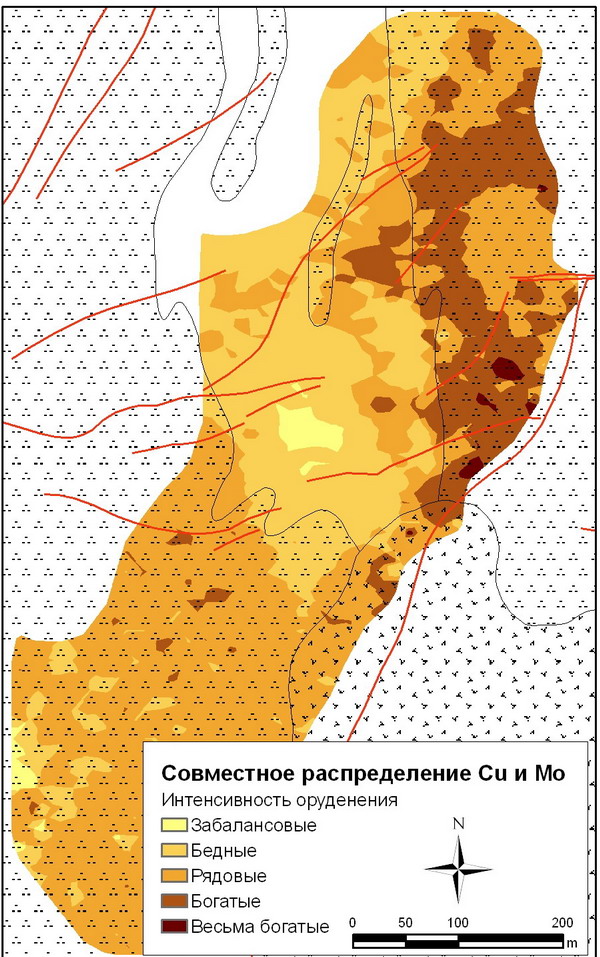
- Surfaces of chemical elements concentrations were constructed, the structure and patterns of the geochemical fields were studied (on the example of Agarak cooper-molybdenum deposit and Geghi river basin).
- Minerals were modeled and mineralization patterns were studied (on the example of Agarak copper-molybdenum deposit).
- Digital elevation models were developed: Slope, inclinations (vertical, horizontal, highest, lowest, and average incline) and vertical ruggedness.
GIS Projects
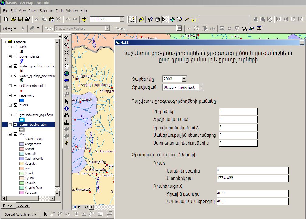
- GIS of State Water Cadastre
- GIS of Pliocene-quaternary Volcanism in Armenia
- GIS of Landslides in RA
- GIS of Natural Hazards and Risks in River Basins of Pambak-Debed and Aghstev rivers
- GIS of Ecological Risks along the lower flow of Hrazdan river
GIS Extensions and Software
- ArcGIS extension for linking spatial data to external relational database.
- ArcGIS extension for exploring geochemistry and geo-ecology
- ArcGIS extension for the construction of the rivers longitudinal profiles on the basis of relief digital model
- ArcGIS extension for calculation of flow module
- Program for calculation of water balance in selected river basins
- Program for the construction of geological cross-sections according to the description of the borehole