


| About Laboratory | Maps and Graphics |
| Scientific Staff and Areas of Study | International Cooperation |
| Scientific Achievements | Publications |
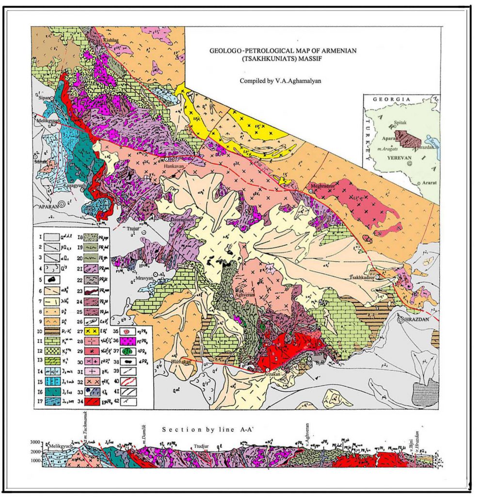
Maps and Graphics
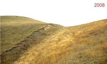
Schematic scenario for the two last earthquakes having ruptured the western fault within the Gailahovit Valley: 1- first seismic event, 2- accumulation of S1 sedimentary unit, 3- erosion, 4- second seismic event, 5- accumulation of S0 sedimentary unit.
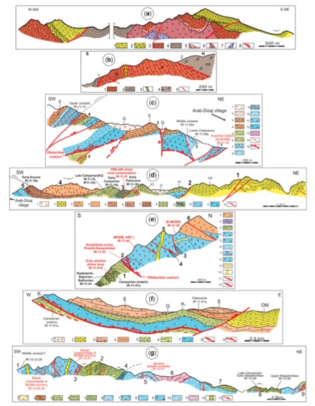
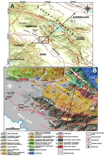
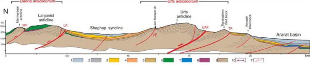
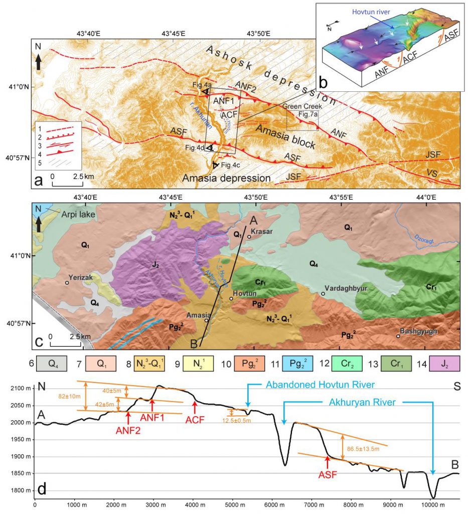
(b) Geological map of the northern margin of the Ararat depression in SE Armenia (modified from Avanesyan, 2004; Arakelyan, 1949). Key: TIGR. TB, Tigranashen tilted block; ARM. TB, Armash tilted block; KV-SPF, Khor Virap – Sari Pap fault; LF, Lanjanist fault; UF, Urzaberd fault; VF, Vank fault; UAF, Urts-Aghbyur fault; TF, Tigranashen fault. Key for stratigraphic ages: 1. Recent – Late Quaternary; 2. Late Quaternary; 3. Late Pliocene – Early Quaternary; 4. Late Oligocene – Early Miocene; 5. Late Oligocene – Early Miocene; 6. Early Oligocene; 7. Late Eocene; 8. Middle Eocene; 9. Early Eocene; 10. Paleocene; 11. Santonian; 12. Late Coniacian – Early Santonian; 13. Cenomanian – Turonian; 14. Middle Jurassic – Early Cretaceous; 15. Early Triassic; 16. Early – Late Permian; 17. Early Carboniferous; 18. Late Devonian; 19. Late Oligocene – Early Pliocene.
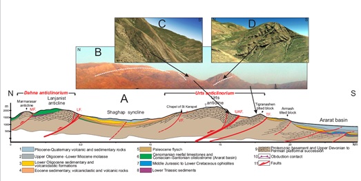
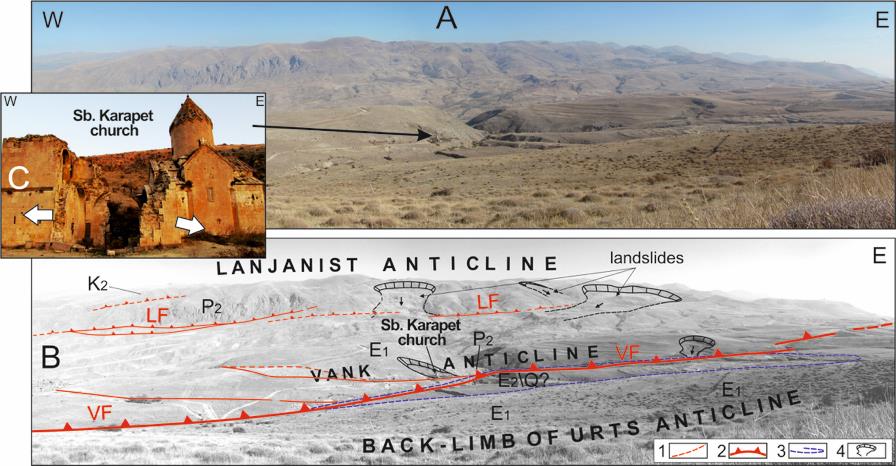
The anticlines are interpreted as fault-propagation folds located in the hangingwalls of major north-dipping thrust faults. LF, Lanjanist fault; UF, Urzaberd fault; VF, Vank fault; UAF, Urts-Aghbyur fault; TF, Tigranashen fault. B. Field photograph of the Urts anticline and Tigranashen tilted block. C, D. 3D Digital Globe satellite images of the fore-limb of the Urts anticline and the Tigranashen tilted block.
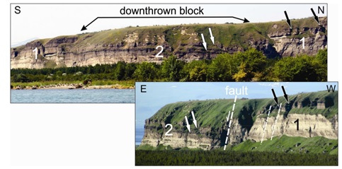
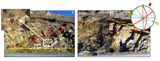
a Quaternary succession at a location about 4km to the SW of Ararat city (location 2, Fig. 1B). See text for details. (b) Field photograph showing slickensides indicating a right-lateral component of movement. (c) Field photograph of the southern portion of the outcrop
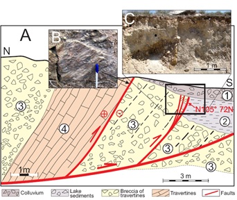
east of the Urts anticline (location 1, Fig. 1B); the thrust plane dips 19o to the north.
(b) Outcrop photograph showing strike-slip faults in Permian limestones. A structural component of NNESSW compression is identified on the Schmidt lower hemisphere projection (red lines are faults; green, anticlinal and synclinal folds; arrows indicate the axes of compression and extension), which indicate a NNESSW oriented compressional axis.